 Tokueimaru No27
Current Status
Where is the vessel?
Tokueimaru No27 is currently in Near HAMAJIMA, based on AIS data received about 15h ago.
Latest AIS update:
Current position: 34.17167° N, 136.84833° E (Near HAMAJIMA)
Average speed (last 7 days): Loading…
Average speed (last 30 days): Loading…
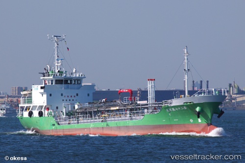
Vessel profile: Tokueimaru No27 is a Oil Products Tanker with dimensions 64m x 10m.
This page combines live AIS, route history, probable destination signals, nearby traffic, and port activity for practical vessel monitoring.
The current position of vessel Tokueimaru No27 is 34.17167 lat / 136.84833 lng. Updated: 2026-05-19 17:34:32 UTCNearest reference points:
- 20 nm S of HAMAJIMA
- Near TOBA
- 12 nm E of TOBA
Currently sailing under the flag of Japan ![]()
Details:
Live Vessel Tokueimaru No27 Analytics (details, animations, etc.)
Recent AIS points (UTC):
2026-05-19 14:19:05 UTC · 33.76722, 136.32011 · SOG 12 kn · COG 48°2026-05-19 16:16:33 UTC · 34.01333, 136.65334 · SOG 10 kn · COG -1°
2026-05-19 16:28:33 UTC · 34.03833, 136.68500 · SOG 10 kn · COG -1°
2026-05-19 17:34:32 UTC · 34.17167, 136.84833 · SOG 10 kn · COG -1°