 BADLANDS TRADER
Current Status
Where is the vessel?
BADLANDS TRADER is currently in 41 nm N of Sebang, based on AIS data received about 2d ago.
Latest AIS update:
Current position: 6.54424° N, 95.06741° E (41 nm N of Sebang)
Average speed (last 7 days): Loading…
Average speed (last 30 days): Loading…
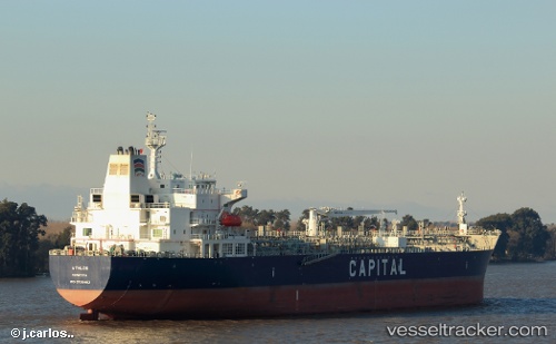
Vessel profile: BADLANDS TRADER is a Chemical Oil Products Tanker with dimensions 32m x 183m.
This page combines live AIS, route history, probable destination signals, nearby traffic, and port activity for practical vessel monitoring.
The current position of vessel BADLANDS TRADER is 6.54424 lat / 95.06741 lng. Updated: 2026-05-20 08:29:23 UTCNearest reference points:
- 28 nm NW of Sebang
- 21 nm N of Sebang
- 48 nm NW of Sebang
Currently sailing under the flag of USA ![]()
BADLANDS TRADER built in 0 year
Deadweight:
0 tDetails:
Live Vessel BADLANDS TRADER Analytics (details, animations, etc.)
Recent AIS points (UTC):
2026-05-20 08:29:23 UTC · 6.54424, 95.06741 · SOG 12.3 kn · COG 250°2026-05-20 08:29:23 UTC · 6.54424, 95.06741 · SOG 12.3 kn · COG 250°
2026-05-20 08:29:23 UTC · 6.54424, 95.06741 · SOG 12.3 kn · COG 250°
2026-05-20 08:29:23 UTC · 6.54424, 95.06741 · SOG 12.3 kn · COG 250°