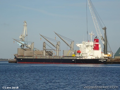
 AGIA MARINA
Current Status
Where is the vessel?
AGIA MARINA is currently in Near Luanda, based on AIS data received about 14h ago.
Latest AIS update:
Current position: 8.71354° S, 13.28397° E (Near Luanda)
Average speed (last 7 days): Loading…
Average speed (last 30 days): Loading…
Vessel profile: AGIA MARINA is a Cargo with dimensions m x m.
This page combines live AIS, route history, probable destination signals, nearby traffic, and port activity for practical vessel monitoring.
The current position of vessel AGIA MARINA is -8.71354 lat / 13.28397 lng. Updated: 2026-05-20 08:04:54 UTCNearest reference points:
- Near Luanda
- Near Greater Plutonio
Currently sailing under the flag of Marshall Islands ![]()
Details:
Live Vessel AGIA MARINA Analytics (details, animations, etc.)
Recent AIS points (UTC):
2026-05-20 04:40:50 UTC · -8.71383, 13.28505 · SOG 0.1 kn · COG 215°2026-05-20 06:01:50 UTC · -8.71367, 13.28477 · SOG 0.1 kn · COG 205°
2026-05-20 07:43:50 UTC · -8.71344, 13.28397 · SOG 0.1 kn · COG 173°
2026-05-20 08:04:54 UTC · -8.71354, 13.28397 · SOG 0.2 kn · COG 175°