 vesseltracker.com
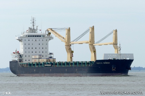
Pacific Harmony
Current StatusWhere is the vessel?
Pacific Harmony is currently in 69 nm E of Kalpeni Island, based on AIS data received about 2h ago.
Latest AIS update:
Current position: 10.24945° N, 74.79104° E (69 nm E of Kalpeni Island)
Average speed (last 7 days): Loading…
Average speed (last 30 days): Loading…
Vessel profile: Pacific Harmony is a Multi Purpose Carrier with dimensions 28m x 168m.
This page combines live AIS, route history, probable destination signals, nearby traffic, and port activity for practical vessel monitoring.
The current position of vessel Pacific Harmony is 10.24945 lat / 74.79104 lng. Updated: 2026-05-17 14:18:47 UTCNearest reference points:
- Near Cochin
- Near Edappally
- 45 nm SW of Kalpeni Island
Details:
Live Vessel Pacific Harmony Analytics (details, animations, etc.)
Recent AIS points (UTC):
2026-05-17 02:46:46 UTC · 12.13939, 73.82613 · SOG 11.7 kn · COG 152°2026-05-17 02:46:46 UTC · 12.13939, 73.82613 · SOG 11.7 kn · COG 152°
2026-05-17 02:46:46 UTC · 12.13939, 73.82613 · SOG 11.7 kn · COG 152°
2026-05-17 14:18:47 UTC · 10.24945, 74.79104 · SOG 1.1 kn · COG 201°