 TORM KIRSTEN
Current Status
Where is the vessel?
TORM KIRSTEN is currently in 17 nm W of Sanchidrian, based on AIS data received about 14h ago.
Latest AIS update:
Current position: 40.82818° N, 44.20220° W (17 nm W of Sanchidrian)
Average speed (last 7 days): Loading…
Average speed (last 30 days): Loading…
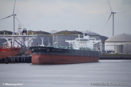
Vessel profile: TORM KIRSTEN is a Crude Oil Tanker with dimensions 254m x 45m.
This page combines live AIS, route history, probable destination signals, nearby traffic, and port activity for practical vessel monitoring.
The current position of vessel TORM KIRSTEN is 40.82818 lat / -44.20220 lng. Updated: 2026-05-20 01:53:29 UTCCurrently sailing under the flag of Denmark (DIS) ![]()
TORM KIRSTEN built in 2015 year
Deadweight:
114445 tDetails:
Live Vessel TORM KIRSTEN Analytics (details, animations, etc.)
Recent AIS points (UTC):
2026-05-19 21:28:01 UTC · 40.59637, -44.93389 · SOG 8.2 kn · COG 66°2026-05-19 22:59:00 UTC · 40.67018, -44.68646 · SOG 7.8 kn · COG 66°
2026-05-19 23:45:00 UTC · 40.70620, -44.56539 · SOG 7.8 kn · COG 64°
2026-05-20 01:53:29 UTC · 40.82818, -44.20220 · SOG 8.7 kn · COG 70°