 vesseltracker.com
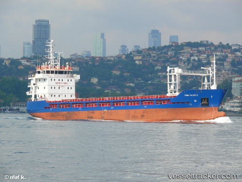
 Turk Yildizi 2
Current Status
Where is the vessel?
Turk Yildizi 2 is currently in 14 nm W of Agía Pelagía, based on AIS data received less than 1h ago.
Latest AIS update:
Current position: 36.39552° N, 22.69565° E (14 nm W of Agía Pelagía)
Average speed (last 7 days): Loading…
Average speed (last 30 days): Loading…
Vessel profile: Turk Yildizi 2 is a General Cargo Ship with dimensions 83m x 16m.
This page combines live AIS, route history, probable destination signals, nearby traffic, and port activity for practical vessel monitoring.
The current position of vessel Turk Yildizi 2 is 36.39552 lat / 22.69565 lng. Updated: 2026-05-14 05:58:56 UTCNearest reference points:
- 17 nm S of Areópolis
- Near Kythira
- 20 nm E of FOKIANOS
Currently sailing under the flag of Turkey ![]()
Details:
Live Vessel Turk Yildizi 2 Analytics (details, animations, etc.)
Recent AIS points (UTC):
2026-05-14 02:06:35 UTC · 36.52911, 23.30324 · SOG 9.3 kn · COG 207°2026-05-14 03:55:47 UTC · 36.42079, 23.04611 · SOG 7.8 kn · COG 283°
2026-05-14 05:07:02 UTC · 36.41771, 22.84715 · SOG 8.6 kn · COG 259°
2026-05-14 05:58:56 UTC · 36.39552, 22.69565 · SOG 8.5 kn · COG 260°