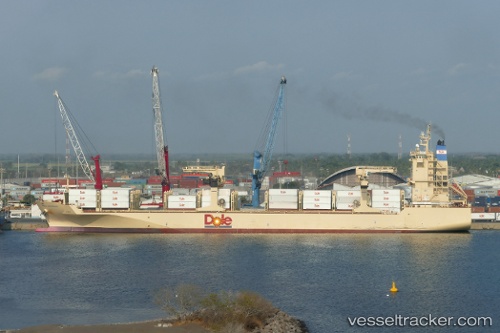
 Dole Caribbean
Current Status
Where is the vessel?
Dole Caribbean is currently in Near San Diego, based on AIS data received about 14h ago.
Latest AIS update:
Current position: 32.69942° N, 117.15954° W (Near San Diego)
Average speed (last 7 days): Loading…
Average speed (last 30 days): Loading…
Vessel profile: Dole Caribbean is a Container Ship with dimensions 190m x 190m.
This page combines live AIS, route history, probable destination signals, nearby traffic, and port activity for practical vessel monitoring.
The current position of vessel Dole Caribbean is 32.69942 lat / -117.15954 lng. Updated: 2026-05-26 00:13:01 UTCNearest reference points:
- Near Coronado
- Near San Diego
- Near Ocean Beach
Currently sailing under the flag of Bahamas ![]()
Details:
Live Vessel Dole Caribbean Analytics (details, animations, etc.)
Recent AIS points (UTC):
2026-05-25 20:01:02 UTC · 32.69940, -117.15953 · SOG 0.1 kn · COG 310°2026-05-25 21:49:37 UTC · 32.69938, -117.15954 · SOG 0.1 kn · COG 309°
2026-05-25 22:31:02 UTC · 32.69945, -117.15952 · SOG 0.1 kn · COG 309°
2026-05-26 00:13:01 UTC · 32.69942, -117.15954 · SOG 0.1 kn · COG 310°