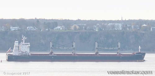
 STAR WESTPORT
Current Status
Where is the vessel?
STAR WESTPORT is currently in 42 nm NE of Belawan, based on AIS data received about 14h ago.
Latest AIS update:
Current position: 4.32109° N, 99.13281° E (42 nm NE of Belawan)
Average speed (last 7 days): Loading…
Average speed (last 30 days): Loading…
Vessel profile: STAR WESTPORT is a Cargo with dimensions m x m.
This page combines live AIS, route history, probable destination signals, nearby traffic, and port activity for practical vessel monitoring.
The current position of vessel STAR WESTPORT is 4.32109 lat / 99.13281 lng. Updated: 2026-05-26 21:53:34 UTCNearest reference points:
- 43 nm NE of Perbaungan
- 43 nm NE of PANGKALAN SUSU
- 10 nm NE of Belawan
Currently sailing under the flag of Liberia ![]()
Details:
Live Vessel STAR WESTPORT Analytics (details, animations, etc.)
Recent AIS points (UTC):
2026-05-26 17:44:24 UTC · 4.77549, 98.57647 · SOG 10.7 kn · COG 130°2026-05-26 19:32:14 UTC · 4.58202, 98.82534 · SOG 10.3 kn · COG 130°
2026-05-26 19:47:23 UTC · 4.55438, 98.85907 · SOG 10.2 kn · COG 130°
2026-05-26 21:53:34 UTC · 4.32109, 99.13281 · SOG 10.2 kn · COG 135°