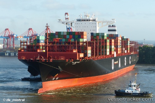
 AL NEFUD
Current Status
Where is the vessel?
AL NEFUD is currently in 62 nm NW of Nouadhibou, based on AIS data received about 15h ago.
Latest AIS update:
Current position: 21.38890° N, 17.97030° W (62 nm NW of Nouadhibou)
Average speed (last 7 days): Loading…
Average speed (last 30 days): Loading…
Vessel profile: AL NEFUD is a Cargo A with dimensions m x m.
This page combines live AIS, route history, probable destination signals, nearby traffic, and port activity for practical vessel monitoring.
The current position of vessel AL NEFUD is 21.3889 lat / -17.9703 lng. Updated: 2026-05-20 17:32:37 UTCNearest reference points:
- 41 nm NW of Nouadhibou
- Near Nouadhibou
- 108 nm SW of Port Etienne
Currently sailing under the flag of Germany ![]()
Details:
Live Vessel AL NEFUD Analytics (details, animations, etc.)
Recent AIS points (UTC):
2026-05-20 13:36:04 UTC · 22.61210, -17.72030 · SOG 18.5 kn · COG 191°2026-05-20 16:04:55 UTC · 21.84260, -17.86690 · SOG 19 kn · COG 190°
2026-05-20 17:00:01 UTC · 21.55900, -17.92880 · SOG 18.8 kn · COG 191°
2026-05-20 17:32:37 UTC · 21.38890, -17.97030 · SOG 19.1 kn · COG 190°