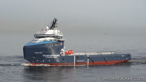
Troms Mira
Current StatusWhere is the vessel?
Troms Mira is currently in 20 nm NE of Anasuria, based on AIS data received about 15h ago.
Latest AIS update:
Current position: 57.37833° N, 1.36333° E (20 nm NE of Anasuria)
Average speed (last 7 days): Loading…
Average speed (last 30 days): Loading…
Vessel profile: Troms Mira is a Offshore Supply Ship with dimensions 18m x 82m.
This page combines live AIS, route history, probable destination signals, nearby traffic, and port activity for practical vessel monitoring.
The current position of vessel Troms Mira is 57.37833 lat / 1.36333 lng. Updated: 2026-05-20 11:39:35 UTCNearest reference points:
- Near Alba Oil Field
- 19 nm W of Curlew
- 10 nm N of Leadon
Details:
Live Vessel Troms Mira Analytics (details, animations, etc.)
Recent AIS points (UTC):
2026-05-20 07:54:35 UTC · 57.45667, 1.38000 · SOG 0 kn · COG -1°2026-05-20 09:00:35 UTC · 57.45167, 1.38333 · SOG 1 kn · COG -1°
2026-05-20 10:08:02 UTC · 57.45143, 1.38600 · SOG 0.5 kn · COG 353°
2026-05-20 11:39:35 UTC · 57.37833, 1.36333 · SOG 3 kn · COG -1°