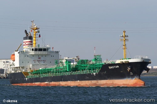
Shotan
Current StatusWhere is the vessel?
Shotan is currently in Near Dumai, based on AIS data received about 14h ago.
Latest AIS update:
Current position: 1.68873° N, 101.45074° E (Near Dumai)
Average speed (last 7 days): Loading…
Average speed (last 30 days): Loading…
Vessel profile: Shotan is a Chemical Oil Products Tanker with dimensions 19m x 114m.
This page combines live AIS, route history, probable destination signals, nearby traffic, and port activity for practical vessel monitoring.
The current position of vessel Shotan is 1.68873 lat / 101.45074 lng. Updated: 2026-05-19 13:10:10 UTCNearest reference points:
- Near Dumai
- 14 nm W of SUNGAI UDANG
- 13 nm SW of PORT DICKSON
Details:
Live Vessel Shotan Analytics (details, animations, etc.)
Recent AIS points (UTC):
2026-05-19 09:46:10 UTC · 1.68870, 101.45073 · SOG 0 kn · COG 88°2026-05-19 11:04:10 UTC · 1.68872, 101.45076 · SOG 0 kn · COG 88°
2026-05-19 11:26:18 UTC · 1.68868, 101.45074 · SOG 0 kn · COG -1°
2026-05-19 13:10:10 UTC · 1.68873, 101.45074 · SOG 0 kn · COG 89°