 vesseltracker.com
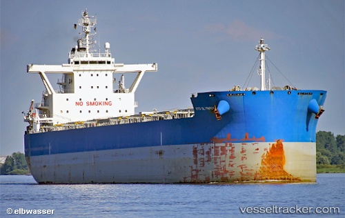
 SERIFOS
Current Status
Where is the vessel?
SERIFOS is currently in Open sea, approx. 435 nm off the nearest listed port, based on AIS data received about 14h ago.
Latest AIS update:
Current position: 33.57386° S, 7.66472° E (Open sea, approx. 435 nm off the nearest listed port)
Average speed (last 7 days): Loading…
Average speed (last 30 days): Loading…
Vessel profile: SERIFOS is a Cargo with dimensions m x m.
This page combines live AIS, route history, probable destination signals, nearby traffic, and port activity for practical vessel monitoring.
The current position of vessel SERIFOS is -33.57386 lat / 7.66472 lng. Updated: 2026-05-17 22:29:37 UTCNearest reference points:
- Open sea, approx. 435 nm off the nearest listed port
- Open sea, approx. 437 nm off the nearest listed port
- Open sea, approx. 431 nm off the nearest listed port
Currently sailing under the flag of Marshall Islands ![]()
Details:
Live Vessel SERIFOS Analytics (details, animations, etc.)
Recent AIS points (UTC):
2026-05-17 19:31:39 UTC · -33.66817, 8.37559 · SOG 12.2 kn · COG 277°2026-05-17 20:07:39 UTC · -33.64833, 8.23167 · SOG 12 kn · COG -1°
2026-05-17 21:39:59 UTC · -33.59924, 7.86427 · SOG 12 kn · COG 276°
2026-05-17 22:29:37 UTC · -33.57386, 7.66472 · SOG 12.2 kn · COG 276°