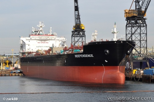
 Independence
Current Status
Where is the vessel?
Independence is currently in Near Tampa, based on AIS data received about 14h ago.
Latest AIS update:
Current position: 27.91483° N, 82.44264° W (Near Tampa)
Average speed (last 7 days): Loading…
Average speed (last 30 days): Loading…
Vessel profile: Independence is a Chemical Oil Products Tanker with dimensions 186m x 32m.
This page combines live AIS, route history, probable destination signals, nearby traffic, and port activity for practical vessel monitoring.
The current position of vessel Independence is 27.91483 lat / -82.44264 lng. Updated: 2026-06-13 02:47:15 UTCNearest reference points:
- Near Tampa
- Near St. Petersburg
- Near Saint Petersburg
Currently sailing under the flag of USA ![]()
Details:
Live Vessel Independence Analytics (details, animations, etc.)
Recent AIS points (UTC):
2026-06-12 23:08:21 UTC · 27.91478, -82.44266 · SOG 0 kn · COG 334°2026-06-12 23:32:15 UTC · 27.91479, -82.44262 · SOG 0 kn · COG 333°
2026-06-13 02:05:17 UTC · 27.91477, -82.44263 · SOG 0 kn · COG 334°
2026-06-13 02:47:15 UTC · 27.91483, -82.44264 · SOG 0 kn · COG 334°