Anthea Y
Current StatusWhere is the vessel?
Anthea Y is currently in 22 nm SW of Parit Raja, based on AIS data received about 14h ago.
Latest AIS update:
Current position: 1.66293° N, 102.81891° E (22 nm SW of Parit Raja)
Average speed (last 7 days): Loading…
Average speed (last 30 days): Loading…
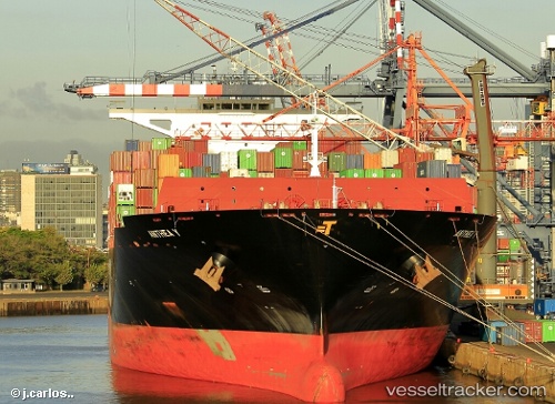
Vessel profile: Anthea Y is a Container Ship with dimensions 48m x 300m.
This page combines live AIS, route history, probable destination signals, nearby traffic, and port activity for practical vessel monitoring.
The current position of vessel Anthea Y is 1.66293 lat / 102.81891 lng. Updated: 2026-05-19 02:13:28 UTCNearest reference points:
- 29 nm W of Parit Raja
- 17 nm NE of Perawang
- 12 nm S of Tangkak
Details:
Live Vessel Anthea Y Analytics (details, animations, etc.)
Recent AIS points (UTC):
2026-05-18 22:25:58 UTC · 1.23209, 103.65685 · SOG 8.3 kn · COG 160°2026-05-19 00:15:39 UTC · 1.33944, 103.27092 · SOG 18.1 kn · COG 302°
2026-05-19 02:06:46 UTC · 1.64522, 102.84312 · SOG 16.1 kn · COG 305°
2026-05-19 02:13:28 UTC · 1.66293, 102.81891 · SOG 15.7 kn · COG 295°