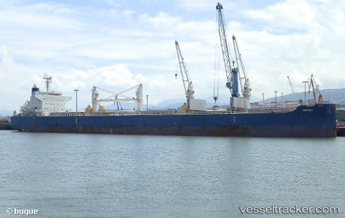
Nemea
Current StatusWhere is the vessel?
Nemea is currently in Open sea, approx. 411 nm off the nearest listed port, based on AIS data received about 14h ago.
Latest AIS update:
Current position: 30.24739° N, 126.90042° W (Open sea, approx. 411 nm off the nearest listed port)
Average speed (last 7 days): Loading…
Average speed (last 30 days): Loading…
Vessel profile: Nemea is a Bulk Carrier with dimensions 32m x 200m.
This page combines live AIS, route history, probable destination signals, nearby traffic, and port activity for practical vessel monitoring.
The current position of vessel Nemea is 30.24739 lat / -126.90042 lng. Updated: 2026-05-22 10:45:43 UTCNearest reference points:
- Open sea, approx. 411 nm off the nearest listed port
- Open sea, approx. 405 nm off the nearest listed port
- Open sea, approx. 402 nm off the nearest listed port
Details:
Live Vessel Nemea Analytics (details, animations, etc.)
Recent AIS points (UTC):
2026-05-22 07:37:31 UTC · 30.58274, -127.58996 · SOG 12.8 kn · COG 119°2026-05-22 07:58:32 UTC · 30.54384, -127.51519 · SOG 12.9 kn · COG 119°
2026-05-22 10:19:42 UTC · 30.29456, -126.99437 · SOG 13 kn · COG 119°
2026-05-22 10:45:43 UTC · 30.24739, -126.90042 · SOG 12.9 kn · COG 120°