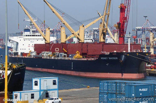
 HONEY BADGER
Current Status
Where is the vessel?
HONEY BADGER is currently in 26 nm NE of Neeltje Jans, based on AIS data received about 14h ago.
Latest AIS update:
Current position: 53.94761° N, 4.19207° E (26 nm NE of Neeltje Jans)
Average speed (last 7 days): Loading…
Average speed (last 30 days): Loading…
Vessel profile: HONEY BADGER is a Cargo with dimensions m x m.
This page combines live AIS, route history, probable destination signals, nearby traffic, and port activity for practical vessel monitoring.
The current position of vessel HONEY BADGER is 53.94761 lat / 4.19207 lng. Updated: 2026-05-19 22:47:05 UTCNearest reference points:
- Near Neeltje Jans
- Near Molengat
- 19 nm NW of Neeltje Jans
Currently sailing under the flag of Liberia ![]()
Details:
Live Vessel HONEY BADGER Analytics (details, animations, etc.)
Recent AIS points (UTC):
2026-05-19 19:19:15 UTC · 54.43709, 4.71124 · SOG 10.5 kn · COG 204°2026-05-19 19:30:34 UTC · 54.40702, 4.68860 · SOG 10.4 kn · COG 205°
2026-05-19 20:11:05 UTC · 54.29985, 4.60995 · SOG 10.4 kn · COG 206°
2026-05-19 22:47:05 UTC · 53.94761, 4.19207 · SOG 10.1 kn · COG 234°