 vesseltracker.com
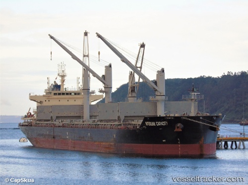
Interlink Capacity
Current StatusWhere is the vessel?
Interlink Capacity is currently in 63 nm S of El Ranchito, based on AIS data received less than 1h ago.
Latest AIS update:
Current position: 17.66823° N, 103.35800° W (63 nm S of El Ranchito)
Average speed (last 7 days): Loading…
Average speed (last 30 days): Loading…
Vessel profile: Interlink Capacity is a Bulk Carrier with dimensions 32m x 179m.
This page combines live AIS, route history, probable destination signals, nearby traffic, and port activity for practical vessel monitoring.
The current position of vessel Interlink Capacity is 17.66823 lat / -103.35800 lng. Updated: 2026-05-14 11:14:26 UTCNearest reference points:
- 43 nm SW of Antunez
- 46 nm S of El Ranchito
- Near Lazaro Cardenas
Details:
Live Vessel Interlink Capacity Analytics (details, animations, etc.)
Recent AIS points (UTC):
2026-05-14 07:07:55 UTC · 18.11129, -104.18203 · SOG 13.2 kn · COG 126°2026-05-14 08:10:45 UTC · 17.98167, -103.98333 · SOG 13 kn · COG -1°
2026-05-14 10:07:40 UTC · 17.78667, -103.58833 · SOG 13 kn · COG -1°
2026-05-14 11:14:26 UTC · 17.66823, -103.35800 · SOG 13.6 kn · COG 122°