 vesseltracker.com
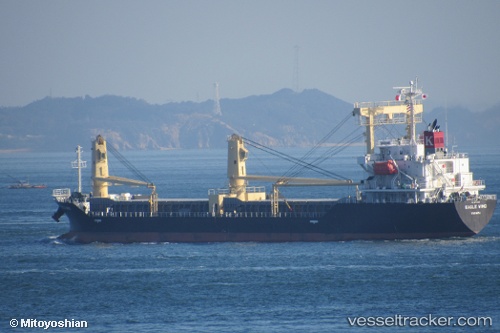
 Eagle Wind
Current Status
Where is the vessel?
Eagle Wind is currently in 14 nm SW of Qisha Pt, based on AIS data received less than 1h ago.
Latest AIS update:
Current position: 21.37868° N, 108.36584° E (14 nm SW of Qisha Pt)
Average speed (last 7 days): Loading…
Average speed (last 30 days): Loading…
Vessel profile: Eagle Wind is a General Cargo Ship with dimensions 121m x 20m.
This page combines live AIS, route history, probable destination signals, nearby traffic, and port activity for practical vessel monitoring.
The current position of vessel Eagle Wind is 21.37868 lat / 108.36584 lng. Updated: 2026-04-27 18:21:53 UTCNearest reference points:
- Near Fangcheng
- 22 nm SE of Dongxing
- Near Qisha Pt
Currently sailing under the flag of Panama ![]()
Details:
Live Vessel Eagle Wind Analytics (details, animations, etc.)
Recent AIS points (UTC):
2026-04-27 13:30:53 UTC · 21.37846, 108.36569 · SOG 0.1 kn · COG 128°2026-04-27 15:33:42 UTC · 21.37869, 108.36589 · SOG 0.2 kn · COG 134°
2026-04-27 16:15:54 UTC · 21.37874, 108.36601 · SOG 0.2 kn · COG 140°
2026-04-27 18:21:53 UTC · 21.37868, 108.36584 · SOG 0.2 kn · COG 139°