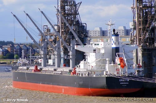
Erietta
Current StatusWhere is the vessel?
Erietta is currently in 12 nm E of VISAKHAPATNAM, based on AIS data received about 15h ago.
Latest AIS update:
Current position: 17.61611° N, 83.50307° E (12 nm E of VISAKHAPATNAM)
Average speed (last 7 days): Loading…
Average speed (last 30 days): Loading…
Vessel profile: Erietta is a Bulk Carrier with dimensions 32m x 199m.
This page combines live AIS, route history, probable destination signals, nearby traffic, and port activity for practical vessel monitoring.
The current position of vessel Erietta is 17.61611 lat / 83.50307 lng. Updated: 2026-05-21 04:54:25 UTCNearest reference points:
- Near Wipro Sez/Resapuvanipalem
- Near Vishakhapatnam
- Near Gopalpur
Details:
Live Vessel Erietta Analytics (details, animations, etc.)
Recent AIS points (UTC):
2026-05-21 01:24:25 UTC · 17.61528, 83.50357 · SOG 0.2 kn · COG 241°2026-05-21 02:21:25 UTC · 17.61615, 83.50306 · SOG 0 kn · COG 222°
2026-05-21 03:45:25 UTC · 17.61612, 83.50304 · SOG 0.1 kn · COG 226°
2026-05-21 04:54:25 UTC · 17.61611, 83.50307 · SOG 0 kn · COG 223°