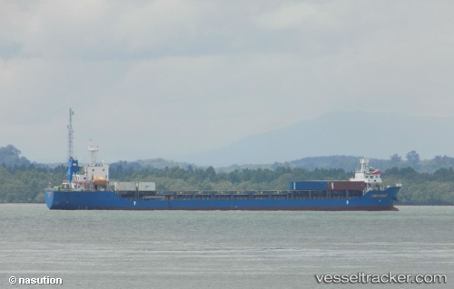
T A N T O S E H A T
Current StatusWhere is the vessel?
T A N T O S E H A T is currently in 35 nm SW of Tanjung Pandan, based on AIS data received about 15h ago.
Latest AIS update:
Current position: 3.22333° S, 107.30833° E (35 nm SW of Tanjung Pandan)
Average speed (last 7 days): Loading…
Average speed (last 30 days): Loading…
Vessel profile: T A N T O S E H A T is a General Cargo Ship with dimensions 22m x 120m.
This page combines live AIS, route history, probable destination signals, nearby traffic, and port activity for practical vessel monitoring.
The current position of vessel T A N T O S E H A T is -3.22333 lat / 107.30833 lng. Updated: 2026-05-20 10:37:19 UTCNearest reference points:
- 46 nm NW of Tanjung Pandan
- 53 nm NE of Tanjung Pandan
- 96 nm E of Widuri
Details:
Live Vessel T A N T O S E H A T Analytics (details, animations, etc.)
Recent AIS points (UTC):
2026-05-20 07:31:17 UTC · -3.73833, 107.27667 · SOG 9 kn · COG -1°2026-05-20 07:55:19 UTC · -3.67500, 107.28667 · SOG 9 kn · COG -1°
2026-05-20 09:46:20 UTC · -3.36833, 107.31167 · SOG 9 kn · COG -1°
2026-05-20 10:37:19 UTC · -3.22333, 107.30833 · SOG 10 kn · COG -1°