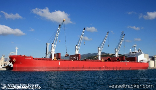
 GLYFADA
Current Status
Where is the vessel?
GLYFADA is currently in 70 nm E of Marsa Alam, based on AIS data received about 14h ago.
Latest AIS update:
Current position: 25.17760° N, 35.79440° E (70 nm E of Marsa Alam)
Average speed (last 7 days): Loading…
Average speed (last 30 days): Loading…
Vessel profile: GLYFADA is a Bulk Carrier with dimensions 199m x 32m.
This page combines live AIS, route history, probable destination signals, nearby traffic, and port activity for practical vessel monitoring.
The current position of vessel GLYFADA is 25.1776 lat / 35.7944 lng. Updated: 2026-07-04 16:08:59 UTCNearest reference points:
- 41 nm NW of Umm Lajj
- 35 nm S of Umm Lajj
- 74 nm SW of Yanbu
Currently sailing under the flag of Malta ![]()
GLYFADA built in 2016 year
Deadweight:
60414 tDetails:
Live Vessel GLYFADA Analytics (details, animations, etc.)
Recent AIS points (UTC):
2026-07-04 13:04:09 UTC · 25.68240, 35.42420 · SOG 11.8 kn · COG 147°2026-07-04 14:02:50 UTC · 25.52230, 35.54000 · SOG 11.7 kn · COG 144°
2026-07-04 16:00:59 UTC · 25.19970, 35.77790 · SOG 12 kn · COG 144°
2026-07-04 16:08:59 UTC · 25.17760, 35.79440 · SOG 12 kn · COG 145°