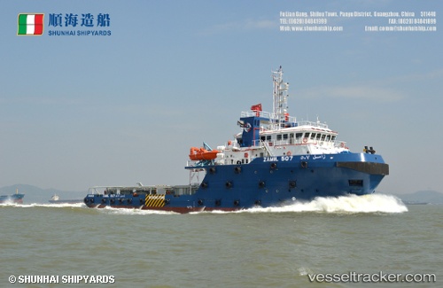
 ZAMIL 507
Current Status
Where is the vessel?
ZAMIL 507 is currently in 13 nm N of Ras Al Khair, based on AIS data received about 14h ago.
Latest AIS update:
Current position: 27.75855° N, 49.16023° E (13 nm N of Ras Al Khair)
Average speed (last 7 days): Loading…
Average speed (last 30 days): Loading…
Vessel profile: ZAMIL 507 is a Tug with dimensions m x m.
This page combines live AIS, route history, probable destination signals, nearby traffic, and port activity for practical vessel monitoring.
The current position of vessel ZAMIL 507 is 27.75855 lat / 49.16023 lng. Updated: 2026-06-23 03:22:14 UTCNearest reference points:
- Near Ras Al Khair
- Near Ras Al-Khair
- 29 nm E of Bandar Al Mishab
Currently sailing under the flag of Saudi Arabia ![]()
Details:
Live Vessel ZAMIL 507 Analytics (details, animations, etc.)
Recent AIS points (UTC):
2026-06-22 23:22:20 UTC · 27.78232, 48.87343 · SOG 0 kn · COG 359°2026-06-23 01:59:04 UTC · 27.75481, 48.96804 · SOG 7.5 kn · COG 105°
2026-06-23 02:17:36 UTC · 27.75028, 49.01041 · SOG 7.4 kn · COG 83°
2026-06-23 03:22:14 UTC · 27.75855, 49.16023 · SOG 7.2 kn · COG 67°