 SEA UNITY
Current Status
Where is the vessel?
SEA UNITY is currently in 115 nm SW of Veraval, based on AIS data received about 17h ago.
Latest AIS update:
Current position: 19.74500° N, 68.72833° E (115 nm SW of Veraval)
Average speed (last 7 days): Loading…
Average speed (last 30 days): Loading…
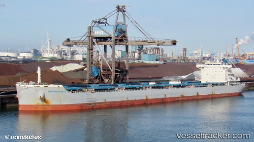
Vessel profile: SEA UNITY is a Cargo with dimensions m x m.
This page combines live AIS, route history, probable destination signals, nearby traffic, and port activity for practical vessel monitoring.
The current position of vessel SEA UNITY is 19.74500 lat / 68.72833 lng. Updated: 2026-06-14 16:13:36 UTCNearest reference points:
- 54 nm S of Positra
- 49 nm S of Positra
- 33 nm S of Mul Dwårka
Currently sailing under the flag of Liberia ![]()
Details:
Live Vessel SEA UNITY Analytics (details, animations, etc.)
Recent AIS points (UTC):
2026-06-14 16:13:36 UTC · 19.74500, 68.72833 · SOG 1 kn · COG -1°2026-06-14 16:13:36 UTC · 19.74500, 68.72833 · SOG 1 kn · COG -1°
2026-06-14 16:13:36 UTC · 19.74500, 68.72833 · SOG 1 kn · COG -1°
2026-06-14 16:13:36 UTC · 19.74500, 68.72833 · SOG 1 kn · COG -1°