 vesseltracker.com
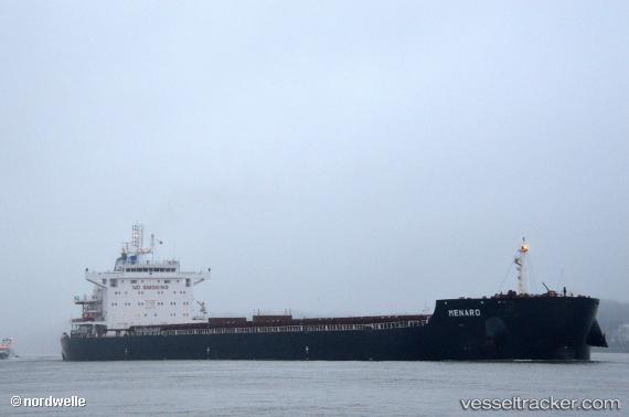
 Menaro
Current Status
Where is the vessel?
Menaro is currently in Near YANGJIANG, based on AIS data received about 15h ago.
Latest AIS update:
Current position: 21.69401° N, 111.81981° E (Near YANGJIANG)
Average speed (last 7 days): Loading…
Average speed (last 30 days): Loading…
Vessel profile: Menaro is a Bulk Carrier with dimensions 229m x 32m.
This page combines live AIS, route history, probable destination signals, nearby traffic, and port activity for practical vessel monitoring.
The current position of vessel Menaro is 21.69401 lat / 111.81981 lng. Updated: 2026-05-17 19:38:41 UTCNearest reference points:
- Near Zhapo
- Near Dongping
- 14 nm W of Hengban
Currently sailing under the flag of Liberia ![]()
Details:
Live Vessel Menaro Analytics (details, animations, etc.)
Recent AIS points (UTC):
2026-05-17 16:20:28 UTC · 21.69405, 111.81983 · SOG 0 kn · COG 339°2026-05-17 18:17:28 UTC · 21.69392, 111.81980 · SOG 0.1 kn · COG 338°
2026-05-17 19:17:27 UTC · 21.69403, 111.81984 · SOG 0 kn · COG 339°
2026-05-17 19:38:41 UTC · 21.69401, 111.81981 · SOG 0 kn · COG 339°