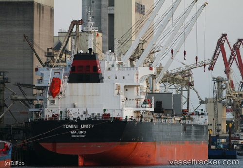
Tomini Unity
Current StatusWhere is the vessel?
Tomini Unity is currently in Near Conakry Eco, based on AIS data received about 14h ago.
Latest AIS update:
Current position: 9.35663° N, 13.68354° W (Near Conakry Eco)
Average speed (last 7 days): Loading…
Average speed (last 30 days): Loading…
Vessel profile: Tomini Unity is a Bulk Carrier with dimensions 32m x 199m.
This page combines live AIS, route history, probable destination signals, nearby traffic, and port activity for practical vessel monitoring.
The current position of vessel Tomini Unity is 9.35663 lat / -13.68354 lng. Updated: 2026-05-21 04:10:10 UTCNearest reference points:
- Near Conakry
- 28 nm S of Conakry
- Near NASSIT
Details:
Live Vessel Tomini Unity Analytics (details, animations, etc.)
Recent AIS points (UTC):
2026-05-21 01:07:57 UTC · 9.35898, -13.68126 · SOG 0.1 kn · COG 230°2026-05-21 01:54:24 UTC · 9.35884, -13.68372 · SOG 0.3 kn · COG 139°
2026-05-21 03:22:10 UTC · 9.35675, -13.68383 · SOG 0.1 kn · COG 46°
2026-05-21 04:10:10 UTC · 9.35663, -13.68354 · SOG 0.1 kn · COG 33°