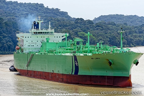
 Bw Libra
Current Status
Where is the vessel?
Bw Libra is currently in Near Jiangyin, based on AIS data received about 15h ago.
Latest AIS update:
Current position: 25.42922° N, 119.25732° E (Near Jiangyin)
Average speed (last 7 days): Loading…
Average speed (last 30 days): Loading…
Vessel profile: Bw Libra is a Lpg Tanker with dimensions 225m x 36m.
This page combines live AIS, route history, probable destination signals, nearby traffic, and port activity for practical vessel monitoring.
The current position of vessel Bw Libra is 25.42922 lat / 119.25732 lng. Updated: 2026-06-13 01:44:27 UTCNearest reference points:
- Near Jiangyin
- Near Jiangkou
- 10 nm NW of Damaiyu
Currently sailing under the flag of United Kingdom ![]()
Details:
Live Vessel Bw Libra Analytics (details, animations, etc.)
Recent AIS points (UTC):
2026-06-12 22:08:25 UTC · 25.42920, 119.25730 · SOG 0 kn · COG 295°2026-06-12 23:47:27 UTC · 25.42920, 119.25732 · SOG 0 kn · COG 295°
2026-06-13 01:11:28 UTC · 25.42922, 119.25730 · SOG 0 kn · COG 295°
2026-06-13 01:44:27 UTC · 25.42922, 119.25732 · SOG 0 kn · COG 295°