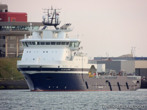
 Island Clipper
Current Status
Where is the vessel?
Island Clipper is currently in Near Damsgård, based on AIS data received about 14h ago.
Latest AIS update:
Current position: 60.38808° N, 5.30917° E (Near Damsgård)
Average speed (last 7 days): Loading…
Average speed (last 30 days): Loading…
Vessel profile: Island Clipper is a Offshore Tug Supply Ship with dimensions 97m x 20m.
This page combines live AIS, route history, probable destination signals, nearby traffic, and port activity for practical vessel monitoring.
The current position of vessel Island Clipper is 60.38808 lat / 5.30917 lng. Updated: 2026-07-07 03:01:58 UTCNearest reference points:
- Near Bergen
- Near Damsgård
- Near Skålevik
Currently sailing under the flag of Norway ![]()
Details:
Live Vessel Island Clipper Analytics (details, animations, etc.)
Recent AIS points (UTC):
2026-07-06 22:25:57 UTC · 60.38809, 5.30911 · SOG 0 kn · COG 310°2026-07-07 00:37:58 UTC · 60.38808, 5.30911 · SOG 0 kn · COG 310°
2026-07-07 00:56:00 UTC · 60.38806, 5.30915 · SOG 0 kn · COG 310°
2026-07-07 03:01:58 UTC · 60.38808, 5.30917 · SOG 0 kn · COG 310°