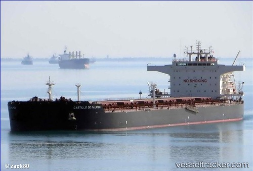
 Castillo De Malpica
Current Status
Where is the vessel?
Castillo De Malpica is currently in 176 nm E of Campohermoso, based on AIS data received about 14h ago.
Latest AIS update:
Current position: 36.24018° N, 19.24648° W (176 nm E of Campohermoso)
Average speed (last 7 days): Loading…
Average speed (last 30 days): Loading…
Vessel profile: Castillo De Malpica is a Bulk Carrier with dimensions m x m.
This page combines live AIS, route history, probable destination signals, nearby traffic, and port activity for practical vessel monitoring.
The current position of vessel Castillo De Malpica is 36.24018 lat / -19.24648 lng. Updated: 2026-07-16 01:05:20 UTCNearest reference points:
- 150 nm NW of Ponta do Pargo
Currently sailing under the flag of Malta ![]()
Details:
Live Vessel Castillo De Malpica Analytics (details, animations, etc.)
Recent AIS points (UTC):
2026-07-15 22:05:10 UTC · 36.25454, -19.95990 · SOG 11.4 kn · COG 90°2026-07-15 22:58:08 UTC · 36.25441, -19.75316 · SOG 11.4 kn · COG 92°
2026-07-15 23:42:51 UTC · 36.24903, -19.57638 · SOG 11.5 kn · COG 93°
2026-07-16 01:05:20 UTC · 36.24018, -19.24648 · SOG 11.8 kn · COG 92°