 Dominica
Current Status
Where is the vessel?
Dominica is currently in Near FAWLEY, based on AIS data received about 14h ago.
Latest AIS update:
Current position: 50.83749° N, 1.32640° W (Near FAWLEY)
Average speed (last 7 days): Loading…
Average speed (last 30 days): Loading…
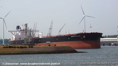
Vessel profile: Dominica is a Crude Oil Tanker with dimensions 336m x 60m.
This page combines live AIS, route history, probable destination signals, nearby traffic, and port activity for practical vessel monitoring.
The current position of vessel Dominica is 50.83749 lat / -1.32640 lng. Updated: 2026-07-05 00:12:27 UTCNearest reference points:
- Near HAMBLE POINT
- Near PORT HAMBLE
- Near MERCURY
Currently sailing under the flag of Liberia ![]()
Details:
Live Vessel Dominica Analytics (details, animations, etc.)
Recent AIS points (UTC):
2026-07-04 19:33:18 UTC · 50.83747, -1.32644 · SOG 0 kn · COG 140°2026-07-04 21:42:21 UTC · 50.83748, -1.32637 · SOG 0 kn · COG 140°
2026-07-04 22:27:21 UTC · 50.83748, -1.32640 · SOG 0 kn · COG 140°
2026-07-05 00:12:27 UTC · 50.83749, -1.32640 · SOG 0 kn · COG 140°