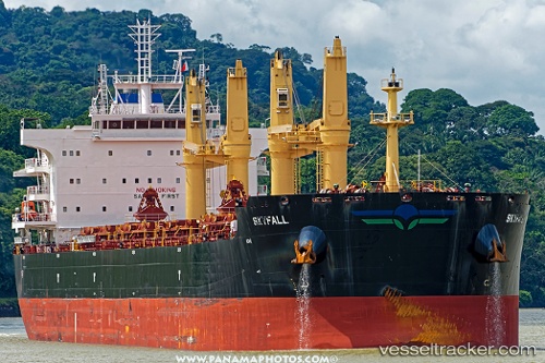
Skyfall
Current StatusWhere is the vessel?
Skyfall is currently in Near Cotonou, based on AIS data received about 14h ago.
Latest AIS update:
Current position: 6.27836° N, 2.54270° E (Near Cotonou)
Average speed (last 7 days): Loading…
Average speed (last 30 days): Loading…
Vessel profile: Skyfall is a Bulk Carrier with dimensions 32m x 199m.
This page combines live AIS, route history, probable destination signals, nearby traffic, and port activity for practical vessel monitoring.
The current position of vessel Skyfall is 6.27836 lat / 2.54270 lng. Updated: 2026-06-09 18:25:58 UTCNearest reference points:
- Near Cotonou
- Near Kirikiri
- Near Apapa
Details:
Live Vessel Skyfall Analytics (details, animations, etc.)
Recent AIS points (UTC):
2026-06-09 14:19:52 UTC · 6.27795, 2.54293 · SOG 0.1 kn · COG 143°2026-06-09 16:19:58 UTC · 6.27845, 2.54297 · SOG 0 kn · COG 154°
2026-06-09 17:07:59 UTC · 6.27820, 2.54278 · SOG 0 kn · COG 144°
2026-06-09 18:25:58 UTC · 6.27836, 2.54270 · SOG 0 kn · COG 142°