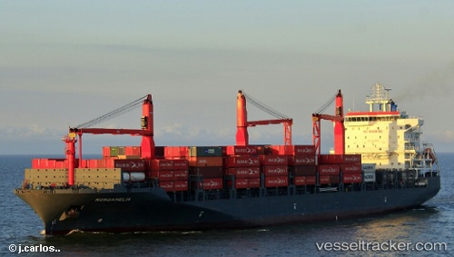
 Nordamelia
Current Status
Where is the vessel?
Nordamelia is currently in 25 nm N of Auderville, based on AIS data received about 15h ago.
Latest AIS update:
Current position: 50.11912° N, 1.76896° W (25 nm N of Auderville)
Average speed (last 7 days): Loading…
Average speed (last 30 days): Loading…
Vessel profile: Nordamelia is a Container Ship with dimensions 195m x 32m.
This page combines live AIS, route history, probable destination signals, nearby traffic, and port activity for practical vessel monitoring.
The current position of vessel Nordamelia is 50.11912 lat / -1.76896 lng. Updated: 2026-06-16 18:11:32 UTCNearest reference points:
- 22 nm S of Holbury
- 11 nm SW of Holbury
- 20 nm S of Holbury
Currently sailing under the flag of Cyprus ![]()
Details:
Live Vessel Nordamelia Analytics (details, animations, etc.)
Recent AIS points (UTC):
2026-06-15 10:25:32 UTC · 49.54494, -0.20012 · SOG 8.3 kn · COG 113°2026-06-16 16:17:08 UTC · 49.83478, -1.11273 · SOG 18.2 kn · COG 300°
2026-06-16 16:17:57 UTC · 49.83675, -1.11818 · SOG 18.1 kn · COG 301°
2026-06-16 18:11:32 UTC · 50.11912, -1.76896 · SOG 15.5 kn · COG 280°