 vesseltracker.com
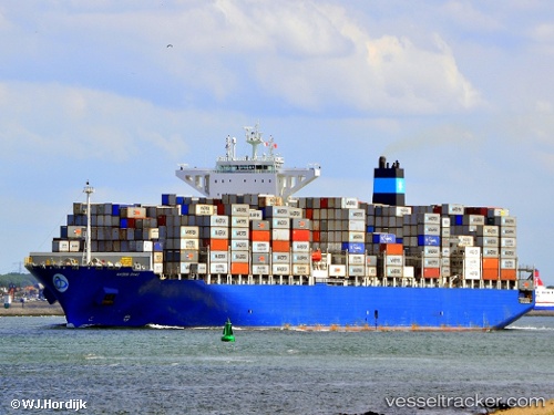
Maersk Sirac
Current StatusWhere is the vessel?
Maersk Sirac is currently in 135 nm S of Accra, based on AIS data received about 3h ago.
Latest AIS update:
Current position: 3.28009° N, 0.08466° E (135 nm S of Accra)
Average speed (last 7 days): Loading…
Average speed (last 30 days): Loading…
Vessel profile: Maersk Sirac is a Container Ship with dimensions 48m x 299m.
This page combines live AIS, route history, probable destination signals, nearby traffic, and port activity for practical vessel monitoring.
The current position of vessel Maersk Sirac is 3.28009 lat / 0.08466 lng. Updated: 2026-04-05 02:32:48 UTCNearest reference points:
- 66 nm N of SAO LUIS
- Near Takoradi
- Near Sekondi
Details:
Live Vessel Maersk Sirac Analytics (details, animations, etc.)
Recent AIS points (UTC):
2026-04-04 22:19:06 UTC · 4.10193, 0.10464 · SOG 11.2 kn · COG 184°2026-04-04 23:44:56 UTC · 3.83027, 0.09861 · SOG 11.5 kn · COG 184°
2026-04-05 00:34:18 UTC · 3.66806, 0.09264 · SOG 11.9 kn · COG 183°
2026-04-05 02:32:48 UTC · 3.28009, 0.08466 · SOG 11.7 kn · COG 182°