 vesseltracker.com
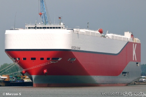
 Horizon Highway
Current Status
Where is the vessel?
Horizon Highway is currently in 181 nm E of Tsuzuki Ku, based on AIS data received about 14h ago.
Latest AIS update:
Current position: 35.94500° N, 135.89166° W (181 nm E of Tsuzuki Ku)
Average speed (last 7 days): Loading…
Average speed (last 30 days): Loading…
Vessel profile: Horizon Highway is a Vehicles Carrier with dimensions 199m x 38m.
This page combines live AIS, route history, probable destination signals, nearby traffic, and port activity for practical vessel monitoring.
The current position of vessel Horizon Highway is 35.94500 lat / -135.89166 lng. Updated: 2026-05-17 23:26:56 UTCCurrently sailing under the flag of Panama ![]()
Details:
Live Vessel Horizon Highway Analytics (details, animations, etc.)
Recent AIS points (UTC):
2026-05-17 20:24:10 UTC · 36.31200, -136.91212 · SOG 18.1 kn · COG 111°2026-05-17 21:21:42 UTC · 36.19947, -136.58012 · SOG 18.3 kn · COG 112°
2026-05-17 22:28:56 UTC · 36.06554, -136.20380 · SOG 17.4 kn · COG 114°
2026-05-17 23:26:56 UTC · 35.94500, -135.89166 · SOG 17 kn · COG -1°