 vesseltracker.com
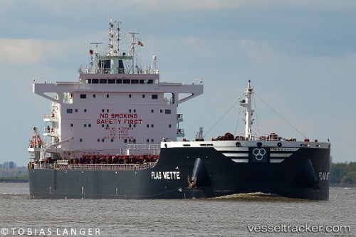
 Flag Mette
Current Status
Where is the vessel?
Flag Mette is currently in Near Guarujá, based on AIS data received less than 1h ago.
Latest AIS update:
Current position: 24.09712° S, 46.25887° W (Near Guarujá)
Average speed (last 7 days): Loading…
Average speed (last 30 days): Loading…
Vessel profile: Flag Mette is a Bulk Carrier with dimensions 229m x 32m.
This page combines live AIS, route history, probable destination signals, nearby traffic, and port activity for practical vessel monitoring.
The current position of vessel Flag Mette is -24.09712 lat / -46.25887 lng. Updated: 2026-05-13 23:37:54 UTCNearest reference points:
- Near Guarujá
- Near Santos
- 30 nm SE of Guarujá
Currently sailing under the flag of Malta ![]()
Details:
Live Vessel Flag Mette Analytics (details, animations, etc.)
Recent AIS points (UTC):
2026-05-13 19:55:57 UTC · -24.09628, -46.25840 · SOG 0 kn · COG 122°2026-05-13 21:43:56 UTC · -24.09672, -46.25873 · SOG 0 kn · COG 108°
2026-05-13 22:33:40 UTC · -24.09667, -46.25833 · SOG 0 kn · COG -1°
2026-05-13 23:37:54 UTC · -24.09712, -46.25887 · SOG 0.3 kn · COG 90°