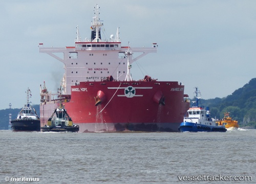
Anangel Hope
Current StatusWhere is the vessel?
Anangel Hope is currently in 54 nm SE of ZHOUSHAN, based on AIS data received about 15h ago.
Latest AIS update:
Current position: 29.45492° N, 123.04282° E (54 nm SE of ZHOUSHAN)
Average speed (last 7 days): Loading…
Average speed (last 30 days): Loading…
Vessel profile: Anangel Hope is a Bulk Carrier with dimensions 45m x 292m.
This page combines live AIS, route history, probable destination signals, nearby traffic, and port activity for practical vessel monitoring.
The current position of vessel Anangel Hope is 29.45492 lat / 123.04282 lng. Updated: 2026-07-09 00:05:19 UTCNearest reference points:
- 61 nm SE of ZHOUSHAN
- 49 nm SE of ZHOUSHAN
- 44 nm SE of ZHOUSHAN
Details:
Live Vessel Anangel Hope Analytics (details, animations, etc.)
Recent AIS points (UTC):
2026-07-08 20:58:10 UTC · 28.92741, 123.01659 · SOG 10.6 kn · COG 357°2026-07-08 22:36:21 UTC · 29.21103, 123.03820 · SOG 9.9 kn · COG 356°
2026-07-08 23:05:50 UTC · 29.29252, 123.04054 · SOG 9.9 kn · COG 359°
2026-07-09 00:05:19 UTC · 29.45492, 123.04282 · SOG 10.5 kn · COG 353°