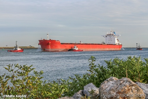
Cotswold
Current StatusWhere is the vessel?
Cotswold is currently in 328 nm S of Rupert's Bay, based on AIS data received about 14h ago.
Latest AIS update:
Current position: 21.19902° S, 4.23613° W (328 nm S of Rupert's Bay)
Average speed (last 7 days): Loading…
Average speed (last 30 days): Loading…
Vessel profile: Cotswold is a Lpg Tanker with dimensions 45m x 292m.
This page combines live AIS, route history, probable destination signals, nearby traffic, and port activity for practical vessel monitoring.
The current position of vessel Cotswold is -21.19902 lat / -4.23613 lng. Updated: 2026-07-15 03:33:06 UTCNearest reference points:
- Open sea, approx. 401 nm off the nearest listed port
- Open sea, approx. 402 nm off the nearest listed port
- Open sea, approx. 403 nm off the nearest listed port
Details:
Live Vessel Cotswold Analytics (details, animations, etc.)
Recent AIS points (UTC):
2026-07-15 00:28:14 UTC · -20.86556, -4.75321 · SOG 11.5 kn · COG 124°2026-07-15 02:24:14 UTC · -21.07465, -4.42717 · SOG 11.2 kn · COG 123°
2026-07-15 02:35:17 UTC · -21.09333, -4.39500 · SOG 11 kn · COG -1°
2026-07-15 03:33:06 UTC · -21.19902, -4.23613 · SOG 11.1 kn · COG 124°