 MARLIN HERA
Current Status
Where is the vessel?
MARLIN HERA is currently in 128 nm SW of Raichur, based on AIS data received about 18h ago.
Latest AIS update:
Current position: 14.78413° N, 79.01213° W (128 nm SW of Raichur)
Average speed (last 7 days): Loading…
Average speed (last 30 days): Loading…
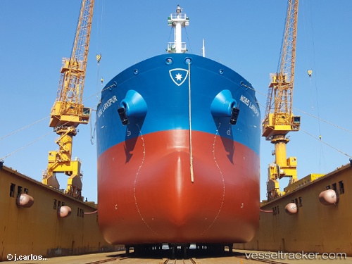
Vessel profile: MARLIN HERA is a Crude Oil Tanker with dimensions 31m x 227m.
This page combines live AIS, route history, probable destination signals, nearby traffic, and port activity for practical vessel monitoring.
The current position of vessel MARLIN HERA is 14.78413 lat / -79.01213 lng. Updated: 2026-05-21 19:41:20 UTCCurrently sailing under the flag of Marshall Islands ![]()
MARLIN HERA built in 2017 year
Deadweight:
74198 tDetails:
Live Vessel MARLIN HERA Analytics (details, animations, etc.)
Recent AIS points (UTC):
2026-05-21 19:15:17 UTC · 14.69885, -79.01298 · SOG 11.8 kn · COG 5°2026-05-21 19:26:33 UTC · 14.73547, -79.01278 · SOG 11.8 kn · COG 5°
2026-05-21 19:41:20 UTC · 14.78413, -79.01213 · SOG 11.6 kn · COG 7°
2026-05-21 19:41:20 UTC · 14.78413, -79.01213 · SOG 11.6 kn · COG 7°