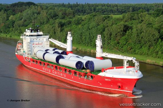
Mick
Current StatusWhere is the vessel?
Mick is currently in Near Castañas, based on AIS data received about 14h ago.
Latest AIS update:
Current position: 13.85833° N, 121.53833° E (Near Castañas)
Average speed (last 7 days): Loading…
Average speed (last 30 days): Loading…
Vessel profile: Mick is a Multi Purpose Carrier with dimensions 23m x 147m.
This page combines live AIS, route history, probable destination signals, nearby traffic, and port activity for practical vessel monitoring.
The current position of vessel Mick is 13.85833 lat / 121.53833 lng. Updated: 2026-05-21 07:36:40 UTCNearest reference points:
- Near Lobo
- 12 nm S of Lobo
- Near MANILA SOUTH HARBOR
Details:
Live Vessel Mick Analytics (details, animations, etc.)
Recent AIS points (UTC):
2026-05-21 03:54:50 UTC · 13.85833, 121.53833 · SOG 0 kn · COG -1°2026-05-21 05:03:44 UTC · 13.85833, 121.53833 · SOG 0 kn · COG -1°
2026-05-21 07:09:42 UTC · 13.85833, 121.53833 · SOG 0 kn · COG -1°
2026-05-21 07:36:40 UTC · 13.85833, 121.53833 · SOG 0 kn · COG -1°