 Auto Energy
Current Status
Where is the vessel?
Auto Energy is currently in 12 nm NW of Bude, based on AIS data received about 14h ago.
Latest AIS update:
Current position: 50.99191° N, 4.74602° W (12 nm NW of Bude)
Average speed (last 7 days): Loading…
Average speed (last 30 days): Loading…
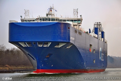
Vessel profile: Auto Energy is a Vehicles Carrier with dimensions 181m x 32m.
This page combines live AIS, route history, probable destination signals, nearby traffic, and port activity for practical vessel monitoring.
The current position of vessel Auto Energy is 50.99191 lat / -4.74602 lng. Updated: 2026-05-20 10:33:04 UTCNearest reference points:
- Near Portwrinkle
- Near TORPOINT
- Near Devonport
Currently sailing under the flag of Portugal ![]()
Details:
Live Vessel Auto Energy Analytics (details, animations, etc.)
Recent AIS points (UTC):
2026-05-20 07:21:59 UTC · 50.66808, -5.31223 · SOG 8.9 kn · COG 44°2026-05-20 07:30:56 UTC · 50.68337, -5.28645 · SOG 9 kn · COG 46°
2026-05-20 09:55:45 UTC · 50.93124, -4.86036 · SOG 8.9 kn · COG 51°
2026-05-20 10:33:04 UTC · 50.99191, -4.74602 · SOG 9.3 kn · COG 49°