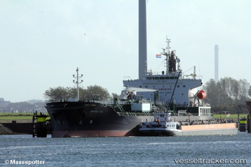
 CHEM SOL
Current Status
Where is the vessel?
CHEM SOL is currently in 102 nm W of Kings Bromley, based on AIS data received about 14h ago.
Latest AIS update:
Current position: 53.09320° N, 151.75984° W (102 nm W of Kings Bromley)
Average speed (last 7 days): Loading…
Average speed (last 30 days): Loading…
Vessel profile: CHEM SOL is a Tanker with dimensions m x m.
This page combines live AIS, route history, probable destination signals, nearby traffic, and port activity for practical vessel monitoring.
The current position of vessel CHEM SOL is 53.09320 lat / -151.75984 lng. Updated: 2026-05-21 03:27:29 UTCCurrently sailing under the flag of Liberia ![]()
Details:
Live Vessel CHEM SOL Analytics (details, animations, etc.)
Recent AIS points (UTC):
2026-05-20 23:39:57 UTC · 52.93623, -150.57268 · SOG 11.7 kn · COG 285°2026-05-21 01:39:13 UTC · 53.02120, -151.19937 · SOG 11.5 kn · COG 282°
2026-05-21 01:40:12 UTC · 53.02190, -151.20454 · SOG 11.5 kn · COG 282°
2026-05-21 03:27:29 UTC · 53.09320, -151.75984 · SOG 11.4 kn · COG 281°