 vesseltracker.com
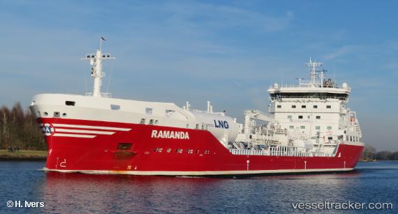
 Ramanda
Current Status
Where is the vessel?
Ramanda is currently in 12 nm S of Craven Arms, based on AIS data received about 1h ago.
Latest AIS update:
Current position: 52.23567° N, 2.75366° E (12 nm S of Craven Arms)
Average speed (last 7 days): Loading…
Average speed (last 30 days): Loading…
Vessel profile: Ramanda is a Chemical Oil Products Tanker with dimensions 150m x 23m.
This page combines live AIS, route history, probable destination signals, nearby traffic, and port activity for practical vessel monitoring.
The current position of vessel Ramanda is 52.23567 lat / 2.75366 lng. Updated: 2026-05-14 20:02:38 UTCNearest reference points:
- 21 nm S of Craven Arms
- Near Craven Arms
- Near Hunsdon
Currently sailing under the flag of Sweden ![]()
Details:
Live Vessel Ramanda Analytics (details, animations, etc.)
Recent AIS points (UTC):
2026-05-14 16:17:58 UTC · 51.75250, 2.15024 · SOG 10.6 kn · COG 38°2026-05-14 17:25:58 UTC · 51.90176, 2.33849 · SOG 9.7 kn · COG 38°
2026-05-14 19:37:22 UTC · 52.17500, 2.69500 · SOG 10 kn · COG -1°
2026-05-14 20:02:38 UTC · 52.23567, 2.75366 · SOG 10 kn · COG 30°