 LAVENDER RAY
Current Status
Where is the vessel?
LAVENDER RAY is currently in 65 nm N of San Ciprian, based on AIS data received about 14h ago.
Latest AIS update:
Current position: 44.78898° N, 7.26071° W (65 nm N of San Ciprian)
Average speed (last 7 days): Loading…
Average speed (last 30 days): Loading…
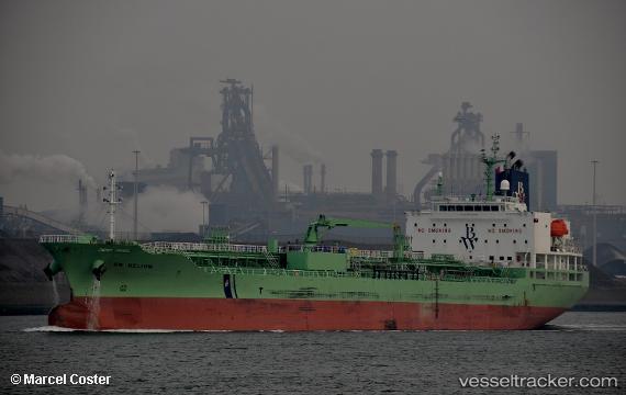
Vessel profile: LAVENDER RAY is a Chemical/Oil Products Tanker with dimensions 24m x 147m.
This page combines live AIS, route history, probable destination signals, nearby traffic, and port activity for practical vessel monitoring.
The current position of vessel LAVENDER RAY is 44.78898 lat / -7.26071 lng. Updated: 2026-05-21 04:11:29 UTCNearest reference points:
- 57 nm S of Boboras
- 22 nm N of Carino
- Near Burela
Currently sailing under the flag of Liberia ![]()
LAVENDER RAY built in 2017 year
Deadweight:
19994 tDetails:
Live Vessel LAVENDER RAY Analytics (details, animations, etc.)
Recent AIS points (UTC):
2026-05-21 01:10:19 UTC · 44.64842, -6.40384 · SOG 12.5 kn · COG 282°2026-05-21 01:51:30 UTC · 44.67895, -6.60392 · SOG 12.1 kn · COG 284°
2026-05-21 03:22:00 UTC · 44.75478, -7.03164 · SOG 12.2 kn · COG 281°
2026-05-21 04:11:29 UTC · 44.78898, -7.26071 · SOG 12.1 kn · COG 279°