 NORDIC GALAXY
Current Status
Where is the vessel?
NORDIC GALAXY is currently in 20 nm E of PENGERANG, based on AIS data received about 15h ago.
Latest AIS update:
Current position: 1.42952° N, 104.48806° E (20 nm E of PENGERANG)
Average speed (last 7 days): Loading…
Average speed (last 30 days): Loading…
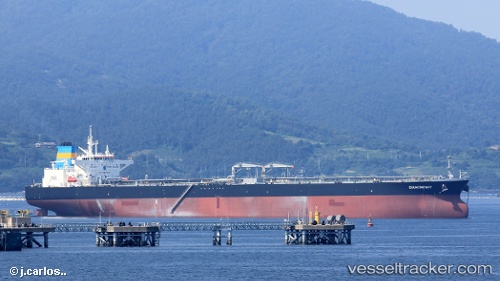
Vessel profile: NORDIC GALAXY is a Tanker with dimensions m x m.
This page combines live AIS, route history, probable destination signals, nearby traffic, and port activity for practical vessel monitoring.
The current position of vessel NORDIC GALAXY is 1.42952 lat / 104.48806 lng. Updated: 2026-05-20 17:39:10 UTCNearest reference points:
- Near PENGERANG
- 34 nm NE of PENGERANG
- 38 nm E of PENGERANG
Currently sailing under the flag of Marshall Islands ![]()
Details:
Live Vessel NORDIC GALAXY Analytics (details, animations, etc.)
Recent AIS points (UTC):
2026-05-20 14:27:37 UTC · 1.25612, 104.10251 · SOG 8.7 kn · COG 77°2026-05-20 15:58:46 UTC · 1.29378, 104.33211 · SOG 9.2 kn · COG 52°
2026-05-20 16:33:16 UTC · 1.34856, 104.39680 · SOG 7.7 kn · COG 50°
2026-05-20 17:39:10 UTC · 1.42952, 104.48806 · SOG 6.7 kn · COG 52°