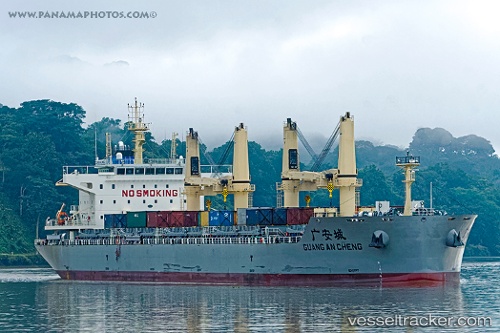
 GUANG AN CHENG
Current Status
Where is the vessel?
GUANG AN CHENG is currently in Open sea, approx. 439 nm off the nearest listed port, based on AIS data received about 15h ago.
Latest AIS update:
Current position: 37.82870° N, 152.25574° E (Open sea, approx. 439 nm off the nearest listed port)
Average speed (last 7 days): Loading…
Average speed (last 30 days): Loading…
Vessel profile: GUANG AN CHENG is a Cargo D with dimensions m x m.
This page combines live AIS, route history, probable destination signals, nearby traffic, and port activity for practical vessel monitoring.
The current position of vessel GUANG AN CHENG is 37.82870 lat / 152.25574 lng. Updated: 2026-07-12 11:33:14 UTCNearest reference points:
- Open sea, approx. 439 nm off the nearest listed port
- Open sea, approx. 436 nm off the nearest listed port
- Open sea, approx. 433 nm off the nearest listed port
Currently sailing under the flag of China ![]()
Details:
Live Vessel GUANG AN CHENG Analytics (details, animations, etc.)
Recent AIS points (UTC):
2026-07-12 07:32:40 UTC · 37.56536, 151.25803 · SOG 12.2 kn · COG 72°2026-07-12 09:44:03 UTC · 37.71075, 151.79753 · SOG 12.5 kn · COG 69°
2026-07-12 10:19:53 UTC · 37.74970, 151.94603 · SOG 12.4 kn · COG 71°
2026-07-12 11:33:14 UTC · 37.82870, 152.25574 · SOG 12.5 kn · COG 76°