 vesseltracker.com
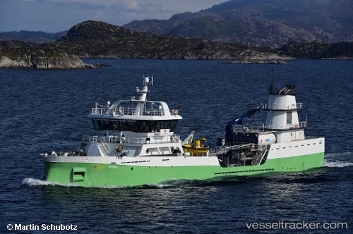
 Ronja Tind
Current Status
Where is the vessel?
Ronja Tind is currently in Near HERJOLFUR, based on AIS data received about 6h ago.
Latest AIS update:
Current position: 63.86145° N, 21.37331° W (Near HERJOLFUR)
Average speed (last 7 days): Loading…
Average speed (last 30 days): Loading…
Vessel profile: Ronja Tind is a Live Fish Carrier with dimensions 70m x 12m.
This page combines live AIS, route history, probable destination signals, nearby traffic, and port activity for practical vessel monitoring.
The current position of vessel Ronja Tind is 63.86145 lat / -21.37331 lng. Updated: 2026-04-30 15:36:03 UTCNearest reference points:
- Near HERJOLFUR
- Near Reykjavik
- Near HAFNARFJORDUR
Currently sailing under the flag of Norway ![]()
Details:
Live Vessel Ronja Tind Analytics (details, animations, etc.)
Recent AIS points (UTC):
2026-04-30 15:36:03 UTC · 63.86145, -21.37331 · SOG 0 kn · COG 295°2026-04-30 15:36:03 UTC · 63.86145, -21.37331 · SOG 0 kn · COG 295°
2026-04-30 15:36:03 UTC · 63.86145, -21.37331 · SOG 0 kn · COG 295°
2026-04-30 15:36:03 UTC · 63.86145, -21.37331 · SOG 0 kn · COG 295°