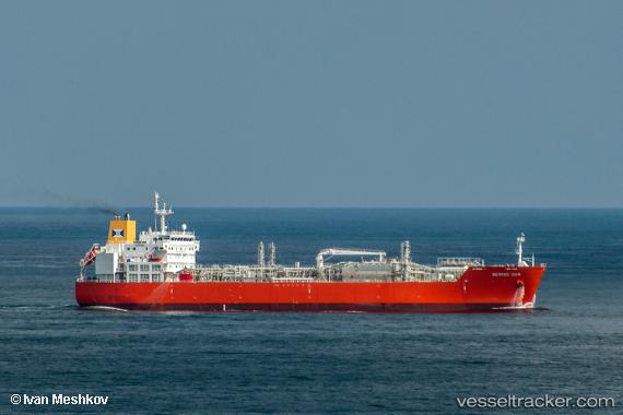
Bering Gas
Current StatusWhere is the vessel?
Bering Gas is currently in 49 nm NW of Jonesville, based on AIS data received about 14h ago.
Latest AIS update:
Current position: 40.29667° N, 54.01167° W (49 nm NW of Jonesville)
Average speed (last 7 days): Loading…
Average speed (last 30 days): Loading…
Vessel profile: Bering Gas is a Lpg Tanker with dimensions 27m x 160m.
This page combines live AIS, route history, probable destination signals, nearby traffic, and port activity for practical vessel monitoring.
The current position of vessel Bering Gas is 40.29667 lat / -54.01167 lng. Updated: 2026-05-20 10:39:32 UTCNearest reference points:
- 44 nm SE of Jonesville
- 63 nm SE of Azuara
- 153 nm NW of Jonesville
Details:
Live Vessel Bering Gas Analytics (details, animations, etc.)
Recent AIS points (UTC):
2026-05-20 07:15:32 UTC · 39.94167, -54.83500 · SOG 13 kn · COG -1°2026-05-20 07:24:30 UTC · 39.95667, -54.79667 · SOG 13 kn · COG -1°
2026-05-20 09:57:33 UTC · 40.22667, -54.17167 · SOG 12 kn · COG -1°
2026-05-20 10:39:32 UTC · 40.29667, -54.01167 · SOG 11 kn · COG -1°