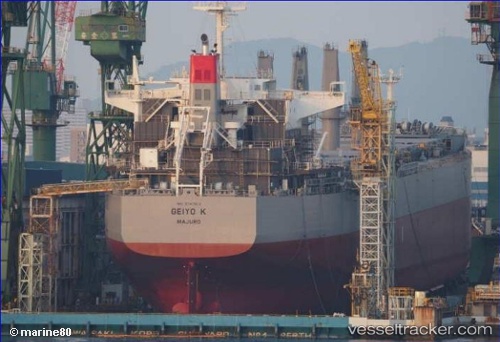
 Geiyo K
Current Status
Where is the vessel?
Geiyo K is currently in 327 nm NE of Fanning Island, based on AIS data received about 15h ago.
Latest AIS update:
Current position: 7.09047° N, 154.95586° W (327 nm NE of Fanning Island)
Average speed (last 7 days): Loading…
Average speed (last 30 days): Loading…
Vessel profile: Geiyo K is a Bulk Carrier with dimensions 190m x 190m.
This page combines live AIS, route history, probable destination signals, nearby traffic, and port activity for practical vessel monitoring.
The current position of vessel Geiyo K is 7.09047 lat / -154.95586 lng. Updated: 2026-05-20 07:44:55 UTCNearest reference points:
- Open sea, approx. 400 nm off the nearest listed port
- Open sea, approx. 405 nm off the nearest listed port
- Open sea, approx. 401 nm off the nearest listed port
Currently sailing under the flag of Marshall Is ![]()
Details:
Live Vessel Geiyo K Analytics (details, animations, etc.)
Recent AIS points (UTC):
2026-05-20 04:29:42 UTC · 6.84938, -154.39632 · SOG 11.4 kn · COG 294°2026-05-20 05:40:34 UTC · 6.93816, -154.59863 · SOG 11.2 kn · COG 295°
2026-05-20 07:43:41 UTC · 7.08904, -154.95236 · SOG 11.3 kn · COG 294°
2026-05-20 07:44:55 UTC · 7.09047, -154.95586 · SOG 11.3 kn · COG 294°