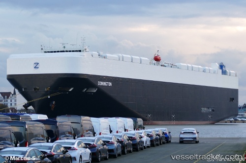
 Donington
Current Status
Where is the vessel?
Donington is currently in 100 nm W of Kozusany-Tazaly, based on AIS data received about 14h ago.
Latest AIS update:
Current position: 49.84196° N, 19.77953° W (100 nm W of Kozusany-Tazaly)
Average speed (last 7 days): Loading…
Average speed (last 30 days): Loading…
Vessel profile: Donington is a Vehicles Carrier with dimensions 199m x 38m.
This page combines live AIS, route history, probable destination signals, nearby traffic, and port activity for practical vessel monitoring.
The current position of vessel Donington is 49.84196 lat / -19.77953 lng. Updated: 2026-07-16 06:54:57 UTCCurrently sailing under the flag of Liberia ![]()
Details:
Live Vessel Donington Analytics (details, animations, etc.)
Recent AIS points (UTC):
2026-07-16 03:47:45 UTC · 49.89318, -18.52911 · SOG 15.3 kn · COG -1°2026-07-16 05:59:08 UTC · 49.85529, -19.41832 · SOG 15.1 kn · COG 267°
2026-07-16 06:54:57 UTC · 49.84196, -19.77953 · SOG 15.3 kn · COG 262°
2026-07-16 06:54:57 UTC · 49.84196, -19.77953 · SOG 15.3 kn · COG 262°