 vesseltracker.com
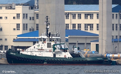
 Michele Foss
Current Status
Where is the vessel?
Michele Foss is currently in Near SABINE PASS, based on AIS data received about 15h ago.
Latest AIS update:
Current position: 29.74156° N, 93.89168° W (Near SABINE PASS)
Average speed (last 7 days): Loading…
Average speed (last 30 days): Loading…
Vessel profile: Michele Foss is a Tug with dimensions 39m x 39m.
This page combines live AIS, route history, probable destination signals, nearby traffic, and port activity for practical vessel monitoring.
The current position of vessel Michele Foss is 29.74156 lat / -93.89168 lng. Updated: 2026-05-18 00:20:58 UTCNearest reference points:
- Near SABINE PASS
- 10 nm W of Sabine Pass
- Near Atreco
Currently sailing under the flag of USA ![]()
Details:
Live Vessel Michele Foss Analytics (details, animations, etc.)
Recent AIS points (UTC):
2026-05-17 19:38:54 UTC · 29.74152, -93.89159 · SOG 0 kn · COG 205°2026-05-17 21:56:56 UTC · 29.74153, -93.89166 · SOG 0 kn · COG 206°
2026-05-17 22:38:54 UTC · 29.74157, -93.89166 · SOG 0 kn · COG 205°
2026-05-18 00:20:58 UTC · 29.74156, -93.89168 · SOG 0 kn · COG 205°