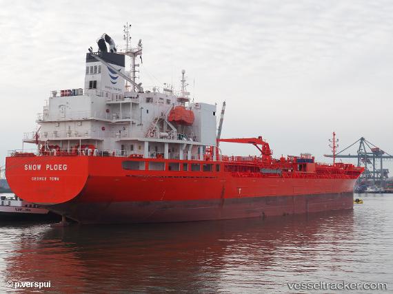
Snow Ploeg
Current StatusWhere is the vessel?
Snow Ploeg is currently in 29 nm N of Krueng Geukueh, based on AIS data received about 14h ago.
Latest AIS update:
Current position: 5.72320° N, 97.14856° E (29 nm N of Krueng Geukueh)
Average speed (last 7 days): Loading…
Average speed (last 30 days): Loading…
Vessel profile: Snow Ploeg is a Chemical Oil Products Tanker with dimensions 24m x 146m.
This page combines live AIS, route history, probable destination signals, nearby traffic, and port activity for practical vessel monitoring.
The current position of vessel Snow Ploeg is 5.72320 lat / 97.14856 lng. Updated: 2026-06-13 04:07:23 UTCNearest reference points:
- 45 nm NE of Krueng Geukueh
- 34 nm N of Langsa Venture FPSO
- 45 nm N of Langsa Venture FPSO
Details:
Live Vessel Snow Ploeg Analytics (details, animations, etc.)
Recent AIS points (UTC):
2026-06-13 01:51:52 UTC · 5.90020, 96.68579 · SOG 12.8 kn · COG -1°2026-06-13 03:07:14 UTC · 5.79464, 96.94400 · SOG 13.3 kn · COG -1°
2026-06-13 04:07:23 UTC · 5.72320, 97.14856 · SOG 12.8 kn · COG -1°
2026-06-13 04:07:23 UTC · 5.72320, 97.14856 · SOG 12.8 kn · COG -1°